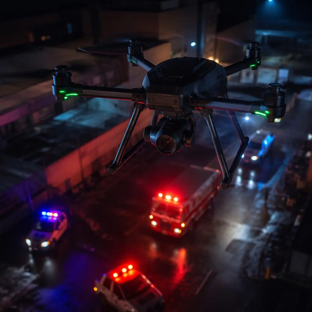
Public safety UAV adoption has crossed the chasm from early-adopter SWAT teams to standard-issue patrol equipment. As of mid-2026, over 5,200 public safety agencies in the United States operate at least one UAV program — up from 1,500 in 2020 — with approximately 80% using the aircraft primarily for search and rescue, 55% for situational awareness at structure fires and hazardous materials incidents, and 30% for crime scene documentation and traffic collision reconstruction. In Europe, the European Union Aviation Safety Agency (EASA) regulatory framework for the Specific category (STS-01 and STS-02 standard scenarios) has created a predictable certification path for public safety UAV operations, and in Asia-Pacific, Japan, South Korea, Singapore and Australia have each published public safety UAV procurement guidelines that drive component-level requirements for imported hardware. The global public safety UAV market is growing at 22–28% CAGR, and the component supply chain is consolidating around standards that prioritize interoperability — so that a thermal camera from one manufacturer works with a flight controller from another and a ground control station from a third.
The public safety UAV component stack has six layers, and the failure of any one layer during a live incident is a mission failure with potential legal consequences. The sensor payload — thermal imager, optical zoom camera, or both on a stabilized gimbal — is the reason the aircraft is in the air; without it, the UAV provides no operational value. The communications link must be encrypted end-to-end and resistant to jamming and interference in the electromagnetically dense urban environments where most public safety incidents occur. The propulsion system must provide motor redundancy with the ability to complete a controlled landing after the failure of any single motor, ESC or propeller — the hexacopter and octocopter configurations are not optional for flight over people; they are the minimum safety architecture. The airframe must deploy from a vehicle or backpack to airborne in under 60 seconds, survive rain, dust and impact, and fold to a size that fits in a patrol vehicle trunk alongside the rest of the equipment. The flight controller must support geofencing around restricted airspace, automatic return-to-launch on signal loss with terrain awareness, and integration with the agency's computer-aided dispatch (CAD) system to receive incident coordinates directly. And the power system must deliver consistent flight time in ambient temperatures from −10°C to +45°C and support hot-swappable battery changes with a turnaround time under 30 seconds between flights. These six layers are not independent — a heavier thermal camera reduces flight time, a stronger encrypted data link draws more power, and a rapid-deployment folding mechanism adds weight that reduces the payload capacity. The component architecture must be designed as a system, with every trade-off modeled against the mission profile.
Thermal imaging payloads: resolution, sensitivity and gimbal stabilization
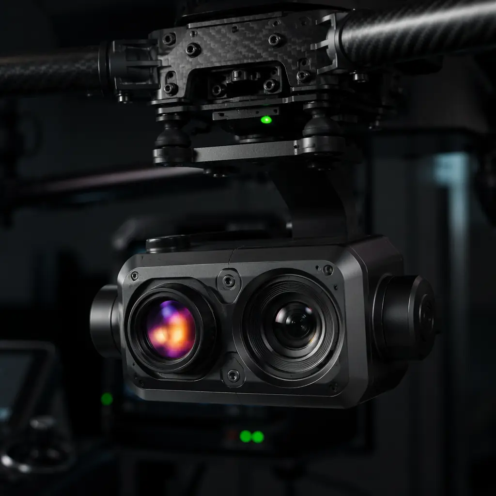
The sensor payload on a public safety UAV is primarily a thermal imaging camera, with an optical zoom camera as a secondary sensor for daylight operations. The thermal camera is the reason a UAV replaces a helicopter for search and rescue — a helicopter with a FLIR turret costs USD 1,500–3,000 per flight hour; a UAV with an equivalent thermal sensor costs USD 2–5 per flight hour in consumables (battery cycles, propeller wear). The thermal camera's performance is defined by three specifications: resolution, thermal sensitivity (NETD, Noise Equivalent Temperature Difference) and the gimbal's stabilization performance.
Resolution and detection range. A 640 × 512 pixel thermal sensor with a 13 mm lens (approximately 24° horizontal field of view) can detect a human-sized heat signature — approximately 0.75 m² of thermal contrast against a background — at 800–1,200 meters under ideal conditions (10°C temperature difference between the person and the background, clear atmosphere, no solar loading on the background surface). At 400 meters, the same sensor resolves the person as approximately 12–15 pixels across, enough for an operator to distinguish a person from a similarly sized warm object (a rock that absorbed sunlight, a deer). A 320 × 256 pixel sensor at the same lens configuration detects a person at 500–700 meters and distinguishes at 250–300 meters — adequate for most urban search scenarios where the search area is a neighborhood, not a wilderness. The sensor resolution translates directly to the search sweep width: a 640 × 512 sensor with a 24° HFOV at 100 meters altitude covers a ground swath of approximately 43 meters, and at 10 m/s flight speed covers approximately 0.43 km² per minute of flight — meaning a 1 km² search area can be systematically swept in 2–3 minutes of flight time with adequate overlap.
Thermal sensitivity and radiometric capability. The NETD of a thermal camera — the smallest temperature difference it can detect — determines whether it can see a person in a thermally complex environment. An NETD of ≤50 mK (0.05°C) at f/1.0 is the threshold for search-and-rescue operations: below this threshold, the camera can distinguish a person's body heat (approximately 34–36°C at the skin surface, or 30–33°C through light clothing) from sun-warmed ground at 28–32°C. An NETD of 30 mK detects a partially submerged person (head above water at 34°C against water at 15–20°C, a 14–19°C ΔT) at 500–800 meters. Radiometric capability — the ability to measure absolute temperature at each pixel rather than just relative contrast — is critical for structure fire operations, where the incident commander needs to know whether a roof surface is at 80°C (hot but structurally stable) or 250°C (imminent collapse). A radiometric thermal camera with ±2°C or ±2% accuracy (whichever is greater) and a measurement range of −20°C to +550°C covers the full spectrum from wilderness search in winter to structural firefighting in summer. For the gimbal and payload integration standards, the UAV payload integration guide covers the mechanical interface, vibration isolation and electrical isolation standards that apply across sensor types.
 Concept illustration
Encrypted communications: data link security for tactical operations
The video feed from a public safety UAV during a tactical operation — a barricaded suspect, a hostage situation, a SWAT entry — is law-enforcement-sensitive information. If the video feed is intercepted by an unauthorized receiver, the suspect or an accomplice monitoring the feed gains real-time intelligence on officer positions, approach vectors and tactical timing. The communications link must provide AES-256 encryption at the data link layer, not just at the application layer, because application-layer encryption leaves the packet headers and metadata (aircraft position, altitude, heading, speed) in plaintext — and the aircraft's position and heading during a tactical operation reveal the direction of the tactical approach.
Encryption architecture. A public safety UAV data link must implement AES-256 encryption in the radio's baseband processor — the hardware layer, not software running on an application processor — with the encryption key generated and exchanged using a Diffie-Hellman or ECDH key agreement protocol during the pairing process between the aircraft and the ground control station. The key must be unique per session (ephemeral key, not stored on the aircraft or the ground station after power-down) and must never be transmitted over the air after the initial pairing handshake. The COFDM (Coded Orthogonal Frequency Division Multiplexing) modulation scheme used by most UAV data links in the 2.4 GHz and 5.8 GHz ISM bands provides inherent resistance to narrowband jamming — a jammer that targets a single frequency within the COFDM channel only degrades a fraction of the subcarriers, and the forward error correction (FEC) coding recovers the lost data. For operations in environments with known jamming threats, a frequency-hopping spread spectrum (FHSS) scheme at 900 MHz or 1.2 GHz provides additional jamming resistance at the cost of reduced data throughput (2–5 Mbps vs. 10–20 Mbps for standard COFDM at 2.4 GHz).
Redundant link architecture. A single data link is a single point of failure. The minimum redundant link architecture for public safety operations is dual-band: a primary link at 2.4 GHz (20 Mbps, 3–5 km range in urban environments, AES-256 encrypted) and a secondary link at 900 MHz or 868 MHz (0.5–2 Mbps, 8–15 km range, AES-256 encrypted). If the primary link degrades — due to interference from the dense Wi-Fi environment in an urban area, or due to obstructions between the aircraft and the ground station — the flight controller automatically switches the video feed to the secondary link at a reduced resolution (720p at 15 fps vs. 1080p at 30 fps on the primary link) and continues the mission. The secondary link also serves as the command-and-control (C2) link for the autopilot, so even if the primary link is completely lost, the operator retains full telemetry and the ability to command a return-to-launch or a loiter hold. For the radio hardware selection and antenna placement methodology, the UAV RF communication systems guide covers the frequency band trade-offs, antenna gain patterns and link budget calculations for multi-band architectures.
Rapid-deployment airframes and motor redundancy
The time from "we need a UAV overhead" to "the UAV is overhead and streaming video" is the most operationally significant metric for public safety UAVs. In a search-and-rescue operation, the survival probability of a lost person decreases by approximately 3–5% per hour after the first 24 hours — every minute of deployment delay is a minute the search area is not being covered. In a structure fire, the fire doubles in size approximately every 30 seconds during the growth phase — a 90-second UAV deployment delay means the incident commander is making decisions about a fire that is 8× larger than the fire they are looking at on the thermal feed. The airframe must enable a sub-60-second deployment from the stowed configuration in a vehicle trunk to airborne with the thermal camera streaming.
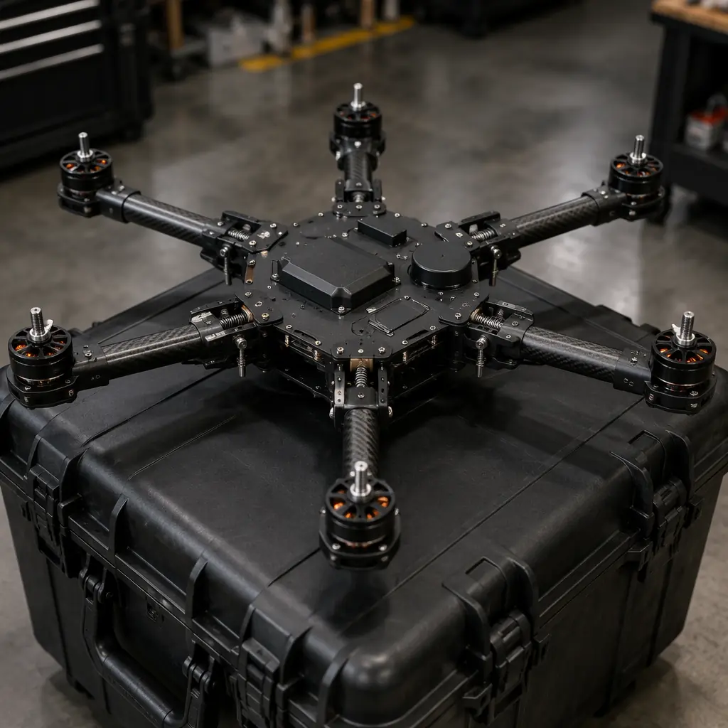
Folding airframe design. The dominant airframe configuration for public safety UAVs is the folding hexacopter — six arms that fold upward and forward for storage (collapsing the 900–1,100 mm wheelbase to approximately 300 × 300 × 200 mm) and lock into position with spring-loaded detent pins or cam levers, not threaded fasteners. The folding mechanism must survive 2,000+ deployment cycles without developing play in the arm pivot joints — play in the arm pivot translates to motor tilt of 0.5–1.0 degrees, which produces a 1–2% thrust vector misalignment that the flight controller compensates for at the cost of reduced efficiency and increased vibration. The arm lock mechanism should be a hardened steel pin (4–6 mm diameter) engaging a steel bushing in the arm pivot — aluminum-on-aluminum pivots gall and develop play within 500 cycles. The carbon fiber arms (20–25 mm diameter tube, 1.5–2.0 mm wall thickness) carry the motor at the tip and the ESC at the root inside the central hub, with the three-phase motor wires running through the tube's interior — no external wiring that can snag during deployment or be cut by debris during a hard landing.
 Concept illustration
Motor redundancy: hexacopter as the minimum configuration. A quadcopter that loses one motor becomes uncontrollable in approximately 0.3–0.5 seconds — the three remaining motors cannot produce balanced yaw torque, and the aircraft enters an unrecoverable spin. A hexacopter that loses one motor can maintain stable attitude and execute a controlled descent — with the five remaining motors operating at approximately 120% of their nominal hover thrust, which is within the burst rating (typically 130–150% of continuous rating for 30–60 seconds) of most commercial UAV motors in the 400–600 KV range at 6S. An octocopter that loses one motor continues flying with minimal degradation — the seven remaining motors operate at approximately 114% of nominal hover thrust, easily within the continuous rating for most motors — but the octocopter's larger folded size (typically 1,200–1,400 mm wheelbase vs. 900–1,100 mm for a hexacopter) reduces the trunk-fit practicality. The hexacopter is the practical minimum for flight-over-people operations, and the octocopter is the standard for operations where the aircraft will routinely fly directly above ground personnel — crowd monitoring at a public event, overwatch at a SWAT perimeter with officers on the ground.
ESC redundancy and independent power distribution. Motor redundancy is meaningless without ESC redundancy — if all six ESCs share a single power distribution board (PDB) and a solder joint on the PDB fails, all six motors lose power simultaneously regardless of the hexacopter configuration. Each ESC must be powered through an independent fuse or current-limiting circuit on the PDB, so a short circuit in one ESC draws current only through its own fuse — not through the common bus, which would cause a system-wide brownout. The ESC-to-motor connections must use bullet connectors or soldered joints at the ESC end and the motor end — not a single connector at the arm pivot that carries all three phases, because a loose connector at the pivot disconnects all three phases simultaneously, killing the motor. For the ESC protocol selection and the matching methodology that enables the flight controller to detect an individual motor failure and compensate within one control loop cycle (1 ms at 1 kHz), the flight controller and ESC matching guide covers the CAN FD and DShot protocol architectures that provide per-ESC telemetry for failure detection.
Weather resistance and all-condition operations
Public safety incidents do not wait for good weather. A search-and-rescue operation for a missing hiker begins in rain because the hiker is getting colder every hour. A structure fire in a commercial building burns regardless of the precipitation. A UAV that cannot fly in rain, snow, 25-knot winds or −10°C ambient temperature is a fair-weather tool — and public safety agencies do not budget for fair-weather tools. The IP rating of the airframe and the wind tolerance of the propulsion system are procurement-level specifications, not nice-to-have features.
Ingress protection: IP43 minimum, IP54 standard. An IP43 rating — protection against water spray at up to 60° from vertical, and against solid objects larger than 1 mm — is the minimum acceptable ingress protection for public safety UAVs. At IP43, the aircraft can fly in light rain (≤2.5 mm/hour precipitation rate) for 20–30 minutes before water penetrates the electronics enclosures. An IP54 rating — protection against water spray from any direction, and limited dust ingress that does not interfere with operation — covers moderate rain (≤10 mm/hour) for the duration of a typical 25–35 minute flight. Achieving IP54 on a UAV with airflow-dependent cooling (ESCs, VTX, flight controller) requires a design trade-off: the electronics enclosures must be sealed against water ingress without sealing against airflow, which means the enclosure must have a Gore-Tex or similar expanded PTFE membrane vent (approximately 10–15 mm diameter) that allows air pressure equalization and convective cooling while blocking liquid water at the membrane's water entry pressure (typically 0.5–1.0 bar, equivalent to a water column of 5–10 meters). The membrane vent adds approximately USD 2–4 and 2–3 grams per enclosure — a negligible cost for the mission assurance it provides.
Wind tolerance and propulsion margin. A public safety UAV must maintain stable hover and GPS position hold in sustained winds of 12 m/s (23 knots, approximately 43 km/h) with gusts to 18 m/s (35 knots). At 12 m/s wind speed, a hexacopter tilts approximately 15–20 degrees into the wind to maintain position — the horizontal component of the total thrust vector equals the airframe's drag at that wind speed plus the wind force on the fuselage cross-section. The propulsion system must provide enough thrust margin at this tilt angle that the vertical component of the thrust vector remains ≥1.0× the aircraft's weight — meaning the total thrust at the maximum wind-corrected throttle setting must be ≥1.0 / cos(20°) = 1.06× the aircraft's weight at a minimum, or approximately 1.2× for adequate gust response margin. A hexacopter with a 2.0:1 static thrust-to-weight ratio at sea level on a standard day has adequate margin for 12 m/s wind operation; at higher density altitudes (hot day, high elevation), the thrust margin decreases proportionally to the air density reduction. For the motor and propeller selection methodology that provides this margin, the UAV powertrain matching guide covers the thrust curve and propeller sizing calculations.
Flight controller and operational software integration
The flight controller on a public safety UAV must do more than stabilize the aircraft — it must enforce safety geofences, integrate with the agency's operational software, and log every flight parameter for the after-action report and potential evidentiary chain-of-custody requirements. The ArduPilot ecosystem provides the safety-critical features: geofencing with polygonal exclusion zones (not just a circular fence), terrain-following RTL that climbs to a safe altitude before returning rather than flying a straight line through obstacles, and automatic motor-failure detection that triggers an immediate controlled descent to a pre-designated safe landing zone.
Geofencing and airspace integration. The flight controller's geofence must support polygonal exclusion zones — not just a single circular fence — because public safety operations often occur near airports, heliports, hospitals with landing pads, military installations and other restricted airspace with irregular boundaries. The geofence file is loaded onto the flight controller before the mission, and the aircraft's GNSS position is checked against the fence at the IMU update rate (8 kHz), not just at the GNSS update rate (10 Hz), using dead-reckoning between GNSS updates to catch fence breaches within 0.1 seconds. When the aircraft approaches within 50 meters of a geofence boundary, the flight controller reduces speed to 2 m/s and issues an audible warning on the ground control station. At 10 meters from the boundary, the aircraft stops and hovers, awaiting operator override — the override must require a two-step confirmation on the ground station (not a single tap) to prevent accidental boundary crossing.
Flight data logging and evidentiary chain of custody. Every flight of a public safety UAV generates data that may become evidence — the video feed that showed the suspect's location, the flight path that documented the search area coverage, the telemetry log that proves the aircraft was at a specific location at a specific time. The flight controller's onboard log must record GNSS position, altitude (barometric and GNSS), attitude, motor RPM, battery voltage and current at 10 Hz minimum, and the log file must be checksummed with SHA-256 and timestamped with a GNSS-disciplined real-time clock (not the flight controller's internal clock, which drifts). After the flight, the log is downloaded to the ground station and stored with a chain-of-custody record — a hash of the log file, a timestamp, the operator's identifier and the incident number. For the flight controller and sensor integration that enables multi-sensor data fusion, the flight controller and ESC matching guide covers the hardware and firmware integration architecture.
Procurement checklist: 8 component decisions for public safety UAVs
These eight component decisions form the minimum procurement gate for a public safety UAV. Each is tied to a specific operational requirement — mission reliability under incident stress and data security under legal scrutiny.
1. Thermal camera resolution and NETD. Minimum 640 × 512 resolution, ≤50 mK NETD, radiometric capability for fire operations. Validate by flying a grid search for a human-sized thermal target at 400 meters range in 15°C ambient: the target must be distinguishable from background thermal clutter by an operator with 10 hours of thermal camera experience.
2. Dual-band encrypted data link. Primary link at 2.4 GHz with AES-256 hardware encryption, secondary link at 900/868 MHz. Validate by flying at 1 km range in an urban environment with ≥20 active Wi-Fi access points: the video feed must not drop below 15 fps or exhibit >500 ms latency on the primary link, and the secondary link must activate automatically within 2 seconds of primary link loss.
3. Hexacopter with per-ESC power protection. Six motors with independent ESC fusing, motor-failure detection at the flight controller, and a controlled descent after motor loss. Validate by disabling one motor in flight at 50 meters altitude: the aircraft must maintain stable attitude and execute a controlled landing within 5 meters of the designated landing point.
4. Sub-60-second deployment. From the stowed configuration in a vehicle trunk to airborne with thermal video streaming. Validate with a timed deployment by a single operator wearing firefighting or tactical gloves: ≤60 seconds from opening the vehicle trunk to the aircraft lifting off with the thermal feed visible on the ground station. For the airframe folding mechanism, see the airframe materials guide for carbon fiber arm design.
5. IP54 ingress protection. Electronics enclosures with PTFE membrane vents, conformally coated PCBs, sealed connectors. Validate by flying for 20 minutes in simulated moderate rain (10 mm/hour from an overhead spray array): post-flight inspection must show no water ingress into any electronics enclosure, and all systems must be fully functional on the subsequent flight without drying.
6. Wind tolerance to 12 m/s sustained. The aircraft must maintain stable hover and ±1 meter position hold in 12 m/s wind. Validate by flying in measured 12 m/s wind conditions: the GPS position log must show <2 meter standard deviation in horizontal position over a 3-minute hover at 30 meters altitude. For the motor and propeller sizing, see the powertrain matching guide.
7. Geofencing with polygonal zones. The flight controller must enforce polygonal geofences with a two-step override. Validate by loading a geofence file with a test polygon and attempting to fly through the fence: the aircraft must stop and hover at the fence boundary, and crossing the boundary must require two deliberate actions on the ground station.
8. Flight data logging with checksummed chain of custody. The flight controller must log GNSS, attitude, motor and power data at ≥10 Hz with SHA-256 checksums. Validate by flying a test mission, downloading the log, computing the checksum independently and comparing to the onboard checksum: they must match exactly. For the data architecture, see the build vs. buy framework for the integration vs. off-the-shelf trade-off analysis.
Explore custom engineering Back to Blog
Continue Reading
UAV Payload Integration Guide
Thermal and optical gimbal mounting, vibration isolation and EMI shielding for public safety sensor payloads.
UAV RF Communication Systems
AES-256 encrypted data links, dual-band redundancy and anti-jamming architectures for tactical operations.
Flight Controller & ESC Matching
Motor failure detection, geofencing and per-ESC telemetry for hexacopter safety architectures.
UAV Powertrain Matching
Motor KV, propeller sizing and thrust margin for 12 m/s wind tolerance and flight-over-people safety.
Airframe Materials Guide
Carbon fiber arm design, folding mechanism durability and IP54 weather sealing for all-condition deployment.